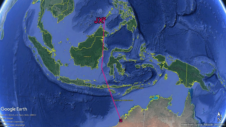
JX photographed in Roebuck Bay on 26 March 2017 by Jack Winterbottom © 2017. Used with permission.
KS photographed in Yilan County, Taiwan on 26 April 2017 by LIN Jer An © 2017. Used with permission.
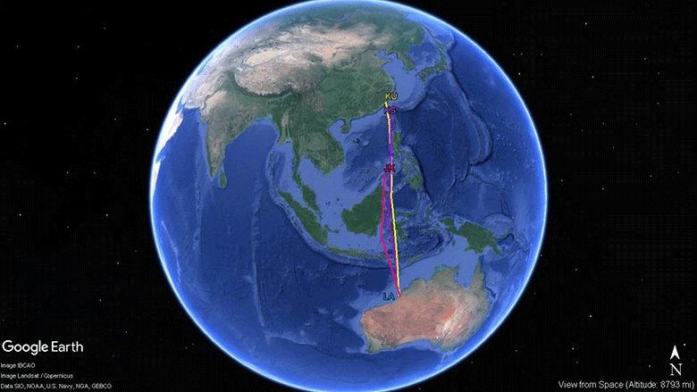
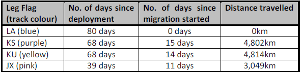
All figures and tables prepared by Katherine Leung for the AWSG. Written by Katherine Leung for the AWSG. Edited and published with permission by Amellia Formby for Wing Threads © 2018.